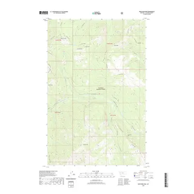
2020 Map of Whitcomb Peak
USGS Topo · Published 2020About this map
Flathead National Forest defines the mountainous landscape of this region, where the Spotted Bear River carves through high-elevation terrain. This modern survey illustrates a network of prominent summits and ridges, including the namesake Whitcomb Peak and the sharp elevation of Gunsight Peak, which overlooks both Gunsight Lake and Gunsight Rock. The drainage patterns are intricate, with Dean Creek, Silvertip Creek, and Sergeant Creek feeding into the larger river system.
Find a feature on this map
36 named features on this map. Tap any name to fly to it.
Don’t see what you’re looking for? This feature index may not catch every label — zoom into the map to look around manually.
Map Details
Editions of this 2020 Whitcomb Peak Map
This is the sole edition of this map. No revisions or reprints were ever made.
Other maps of this area

1913 · Marias Pass
USGS Topo · 1:125,000

1936 · Silvertip
USGS Topo · 1:96,000

1942 · Silvertip
USGS Topo · 1:125,000

1955 · Choteau
USGS Topo · 1:250,000

1957 · Choteau
USGS Topo · 1:250,000

1958 · Choteau
USGS Topo · 1:250,000

1958 · Gable Peaks
USGS Topo · 1:24,000

1958 · Capitol Mountain
USGS Topo · 1:24,000

1958 · Horseshoe Peak
USGS Topo · 1:24,000

1960 · Cut Bank
USGS Topo · 1:250,000