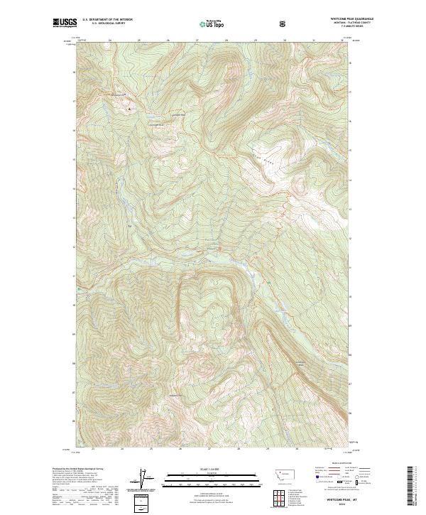
2024 Map of Whitcomb Peak
USGS Topo · Published 2024About this map
The Spotted Bear River carves through the center of this remote mountain landscape, defining a corridor between the high peaks of the Great Bear Wilderness and the Bob Marshall Wilderness. This 2024 map documents a rugged section of the Flathead National Forest where accessibility is defined entirely by trail systems rather than roads. Significant alpine features like Whitcomb Peak and Sergeant Mtn anchor the terrain, while the massive Limestone Wall rises in the southeast. A network of historic routes, including the Gunsight Peak Trl and Silvertip Creek Trl, connects high-altitude landmarks such as Gunsight Lake and Shelf Lake. This survey illustrates the intricate drainage patterns of Whitcomb Creek and Milk Creek as they feed into the primary river valley, offering a detailed view of the natural boundaries and topographic shifts of the northern Rockies.
Find a feature on this map
36 named features on this map. Tap any name to fly to it.
Don’t see what you’re looking for? This feature index may not catch every label — zoom into the map to look around manually.
Map Details
Editions of this 2024 Whitcomb Peak Map
This is the sole edition of this map. No revisions or reprints were ever made.
Other maps of this area

1913 · Marias Pass
USGS Topo · 1:125,000

1936 · Silvertip
USGS Topo · 1:96,000

1942 · Silvertip
USGS Topo · 1:125,000

1955 · Choteau
USGS Topo · 1:250,000

1957 · Choteau
USGS Topo · 1:250,000

1958 · Choteau
USGS Topo · 1:250,000

1958 · Gable Peaks
USGS Topo · 1:24,000

1958 · Capitol Mountain
USGS Topo · 1:24,000

1958 · Horseshoe Peak
USGS Topo · 1:24,000

1960 · Cut Bank
USGS Topo · 1:250,000