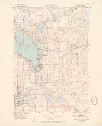
1951 Map of White Bear Lake East
USGS Topo · Published 1952About this map
White Bear Lake dominates this landscape, its eastern shores dotted with the residential and social hubs of Mahtomedi, Birchwood, and Dellwood during the early 1950s. The region exhibits a mix of seasonal leisure and established institutional life, evidenced by the Yacht Club and Manitou Island in the lake, alongside the Jesuit Retreat House near Lake De Montreville. Further south, the community of North St Paul shows a more structured grid, while the surrounding countryside in Oakdale and New Canada maintains a rural character defined by scattered schoolhouses like Castle Sch and School No 80.
Find a feature on this map
57 named features on this map. Tap any name to fly to it.
Don’t see what you’re looking for? This feature index may not catch every label — zoom into the map to look around manually.
Map Details
Editions of this 1951 White Bear Lake East Map
3 editions found

Other maps of this area

1896 · St. Paul
USGS Topo · 1:62,500

1902 · White Bear
USGS Topo · 1:62,500

1946 · Hudson
USGS Topo · 1:62,500

1948 · Stillwater
USGS Topo · 1:62,500

1949 · Hudson
USGS Topo · 1:62,500

1949 · Stillwater
USGS Topo · 1:62,500

1949 · Lake Elmo
USGS Topo · 1:24,000

1949 · Hudson
USGS Topo · 1:24,000

1950 · Lake Elmo
USGS Topo · 1:24,000

1950 · Hudson
USGS Topo · 1:24,000