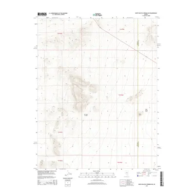
2015 Map of White Blotch Springs NW
USGS Topo · Published 2015About this map
Sharp Peak rises as a prominent landmark within this high-desert landscape, situated along the interior border where the Nye and Lincoln County lines meet. This 2015 survey reveals the basin-and-range topography typical of the region, focusing on the western edges of Sand Spring Valley. The map detail is dominated by topographic contours that define the elevation changes between the valley floor and the surrounding ridges, punctuated by the Public Land Survey System grids for Townships 2 through 4 South. This document serves as a specific reference for the uninhabited terrain before more modern developments or shifts in land management by the Bureau of Land Management, which oversees much of the area. It captures the spatial relationship between the county boundary and the natural drainage patterns that flow into the adjacent flats.
Find a feature on this map
10 named features on this map. Tap any name to fly to it.
Don’t see what you’re looking for? This feature index may not catch every label — zoom into the map to look around manually.
Map Details
Editions of this 2015 White Blotch Springs NW Map
This is the sole edition of this map. No revisions or reprints were ever made.
Other maps of this area

1908 · Kawich
USGS Topo · 1:250,000

1942 · Reveille Peak
USGS Topo · 1:125,000

1942 · Penoyer Valley
USGS Topo · 1:125,000

1952 · White Blotch Springs
USGS Topo · 1:62,500

1952 · Reveille Peak
USGS Topo · 1:62,500

1952 · Belted Peak
USGS Topo · 1:62,500

1954 · Caliente
USGS Topo · 1:250,000

1954 · Goldfield
USGS Topo · 1:250,000

1955 · Goldfield
USGS Topo · 1:250,000

1958 · Goldfield
USGS Topo · 1:250,000