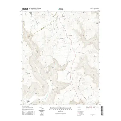
2016 Map of White City
USGS Topo · Published 2016About this map
Cumberland Plateau terrain dominates this 2016 survey of the Tennessee highlands, where the Grundy and Marion county lines meet amidst a complex network of coves and ridges. Small settlements like Lankford Town and Comfort anchor the map, connected by winding mountain roads such as Old Stage Coach Rd and Pidgeon Springs Rd. Local heritage is preserved in sites like the Oak Grove Cem and Gregg Cem, located north of the dramatic escarpments.
Find a feature on this map
79 named features on this map. Tap any name to fly to it.
Don’t see what you’re looking for? This feature index may not catch every label — zoom into the map to look around manually.
Map Details
Editions of this 2016 White City Map
This is the sole edition of this map. No revisions or reprints were ever made.
Other maps of this area

1895 · Sewanee
USGS Topo · 1:125,000

1936 · Palmer
USGS Topo · 1:24,000

1936 · Orme
USGS Topo · 1:24,000

1936 · Whitwell
USGS Topo · 1:24,000

1936 · Burrow Cove
USGS Topo · 1:24,000

1936 · Tracy City
USGS Topo · 1:24,000

1936 · Monteagle
USGS Topo · 1:24,000

1936 · White City
USGS Topo · 1:24,000
1936 · Sequatchie
USGS Topo · 1:24,000
1936 · South Pittsburg
USGS Topo · 1:24,000