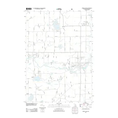
2012 Map of White Cloud
USGS Topo · Published 2012About this map
Lake White Cloud and the winding S Br White River anchor this landscape in central Newaygo County. The geography is defined by a dense network of glacial lakes and small settlements, ranging from the crossroads at Ramona and Lynn to the communities of Jugville and Wooster. Local history and genealogy are well-represented by established landmarks like the Prospect Hill Cem near the town center and the Sherman Township Cem to the southwest. The area's recreational character is evident through the White River Roughing Area Campground and the numerous named water bodies, including Diamond Lake, Crystal Lake, and Robinson Lake. The presence of the White Cloud Airport and the local Post Office underscores the town's role as a regional hub for the surrounding township at the start of the 2010s.
Find a feature on this map
103 named features on this map. Tap any name to fly to it.
Don’t see what you’re looking for? This feature index may not catch every label — zoom into the map to look around manually.
Map Details
Editions of this 2012 White Cloud Map
This is the sole edition of this map. No revisions or reprints were ever made.
Other maps of this area

1954 · Midland
USGS Topo · 1:250,000

1958 · Midland
USGS Topo · 1:250,000

1958 · Sand Lake
USGS Topo · 1:62,500

1958 · Fremont
USGS Topo · 1:62,500

1958 · Woodville
USGS Topo · 1:62,500

1959 · Midland
USGS Topo · 1:250,000

1959 · White Cloud
USGS Topo · 1:62,500

1966 · Midland
USGS Topo · 1:250,000
1976 · White Cloud SW
USGS Topo · 1:24,000

1976 · White Cloud SE
USGS Topo · 1:24,000