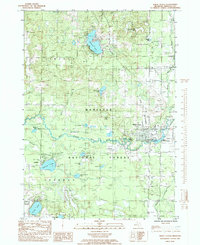
1985 Map of White Cloud
USGS Topo · Published 1985About this map
The White River winds through the heart of this mid-1980s landscape, anchoring the city of White Cloud and the adjacent White Cloud State Park. The region is defined by its abundance of glacial lakes, ranging from the developed shores of Diamond Lake in the north to the quieter waters of Crystal Lake and Robinson Lake further south. Much of the western and central territory is managed as part of the Manistee National Forest, where the terrain is marked by seasonal drainages like Rattlesnake Creek and Coonskin Creek. Transport and infrastructure are represented by the White Cloud Airport and an Old RR Grade that traces the legacy of earlier Michigan logging and rail history. Scattered settlements such as Jugville and Wooster provide additional points of interest for genealogists tracing local families near the Cem located near the southern boundary.
Find a feature on this map
36 named features on this map. Tap any name to fly to it.
Don’t see what you’re looking for? This feature index may not catch every label — zoom into the map to look around manually.
Map Details
Editions of this 1985 White Cloud Map
This is the sole edition of this map. No revisions or reprints were ever made.
Other maps of this area

1954 · Midland
USGS Topo · 1:250,000

1958 · Midland
USGS Topo · 1:250,000

1958 · Sand Lake
USGS Topo · 1:62,500

1958 · Fremont
USGS Topo · 1:62,500

1958 · Woodville
USGS Topo · 1:62,500

1959 · Midland
USGS Topo · 1:250,000

1959 · White Cloud
USGS Topo · 1:62,500

1966 · Midland
USGS Topo · 1:250,000
1976 · White Cloud SW
USGS Topo · 1:24,000

1976 · White Cloud SE
USGS Topo · 1:24,000