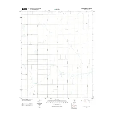
2012 Map of White Deer SW
USGS Topo · Published 2012About this map
McClellan Cr meanders across this High Plains landscape in Carson County, defining the drainage patterns for a region largely organized by an orderly grid of ranch and county roads. This area reflects the modern agricultural and ranching layout of the Texas Panhandle, where the natural course of the creek provides a rare break in the geometric regularity of the land's division. Primary transit is facilitated by north-south corridors like Ranch Road 294 and the western edge's FM-2880, which connect the remote agricultural tracts. A dense network of county roads, including Co Rd AA, Co Rd BB, and Co Rd-13, segments the territory into large parcels typical of large-scale cattle and grain operations. The topography remains subtle, punctuated primarily by the slight depressions and seasonal flow paths associated with the creek system.
Find a feature on this map
18 named features on this map. Tap any name to fly to it.
Don’t see what you’re looking for? This feature index may not catch every label — zoom into the map to look around manually.
Map Details
Editions of this 2012 White Deer SW Map
This is the sole edition of this map. No revisions or reprints were ever made.
Other maps of this area

1954 · Amarillo
USGS Topo · 1:250,000

1958 · Amarillo
USGS Topo · 1:250,000

1960 · Claude
USGS Topo · 1:62,500

1960 · Groom
USGS Topo · 1:62,500

1965 · White Deer
USGS Topo · 1:24,000

1966 · Grandview School
USGS Topo · 1:24,000

1966 · Panhandle East
USGS Topo · 1:24,000

1966 · Cuyler
USGS Topo · 1:24,000

1966 · White Deer SW
USGS Topo · 1:24,000

1966 · Kingsmill
USGS Topo · 1:24,000