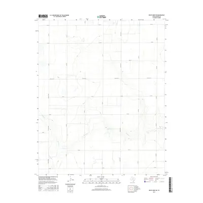
2016 Map of White Deer SW
USGS Topo · Published 2016About this map
McClellan Cr carves a winding path through the southwest corner of Carson County, defining the primary drainage for this portion of the Texas Panhandle. The landscape is characterized by a regular grid of section roads, including Co RD 13 and Co RD 5, which organize the territory for large-scale agricultural use. A significant local landmark, the Horn Reservoir is located along a tributary of the creek, serving as a vital water management feature in this arid environment. The map details the transition from high plains to the breaks of the creek valley, where the topography becomes increasingly complex compared to the flat, subdivided rangelands to the north. Transportation across this rural expanse is facilitated by several designated ranch roads such as Ranch Rd 294 and Ranch Rd 293, which connect the scattered homesteads and ranching operations of the region.
Find a feature on this map
19 named features on this map. Tap any name to fly to it.
Don’t see what you’re looking for? This feature index may not catch every label — zoom into the map to look around manually.
Map Details
Editions of this 2016 White Deer SW Map
This is the sole edition of this map. No revisions or reprints were ever made.
Other maps of this area

1954 · Amarillo
USGS Topo · 1:250,000

1958 · Amarillo
USGS Topo · 1:250,000

1960 · Claude
USGS Topo · 1:62,500

1960 · Groom
USGS Topo · 1:62,500

1965 · White Deer
USGS Topo · 1:24,000

1966 · Grandview School
USGS Topo · 1:24,000

1966 · Panhandle East
USGS Topo · 1:24,000

1966 · Cuyler
USGS Topo · 1:24,000

1966 · White Deer SW
USGS Topo · 1:24,000

1966 · Kingsmill
USGS Topo · 1:24,000