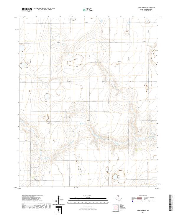
2022 Map of White Deer SW
USGS Topo · Published 2022About this map
McClellan Creek meanders through this section of Carson County, defining the primary drainage pattern across an otherwise structured landscape of agricultural and ranching parcels. The terrain is organized by a geometric network of local routes, including Co Rd V, Co Rd W, and Co Rd X, which segment the Panhandle plains into large-scale tracts. This modern topographic survey by the U.S. Geological Survey reflects the enduring rural character of the region, where the intersection of natural waterways like McClellan Cr and the rigid section-line road system remains the primary geographic framework. The map provides a detailed record of the local transportation infrastructure, from primary ranch roads like Ranch Rd 293 to the numerous lettered county roads that serve the area's spread-out homesteads and agricultural operations.
Find a feature on this map
19 named features on this map. Tap any name to fly to it.
Don’t see what you’re looking for? This feature index may not catch every label — zoom into the map to look around manually.
Map Details
Editions of this 2022 White Deer SW Map
This is the sole edition of this map. No revisions or reprints were ever made.
Other maps of this area

1954 · Amarillo
USGS Topo · 1:250,000

1958 · Amarillo
USGS Topo · 1:250,000

1960 · Claude
USGS Topo · 1:62,500

1960 · Groom
USGS Topo · 1:62,500

1965 · White Deer
USGS Topo · 1:24,000

1966 · Grandview School
USGS Topo · 1:24,000

1966 · Panhandle East
USGS Topo · 1:24,000

1966 · Cuyler
USGS Topo · 1:24,000

1966 · White Deer SW
USGS Topo · 1:24,000

1966 · Kingsmill
USGS Topo · 1:24,000