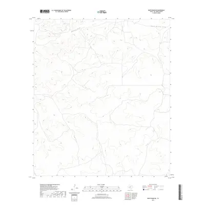
2019 Map of White Draw NE
USGS Topo · Published 2019About this map
Dolan Cr carves through the undulating topography of Val Verde County, Texas, in this detailed look at a remote stretch of the Edwards Plateau. The landscape is defined by its drainage patterns, with Buckley Draw and its southern branch, South Buckley Draw, shaping the high ground in the northern reaches. This 2019 survey, produced by the U.S. Geological Survey, uses data from the National Hydrography Dataset and National Elevation Dataset to trace the intricate networks of dry washes and intermittent streams that characterize this arid region. The map reveals a sparsely populated terrain where few roads penetrate the complex system of draws and ridges, offering a precise record of the natural contours and watercourses that dictate land use in this part of West Texas.
Find a feature on this map
3 named features on this map. Tap any name to fly to it.
Don’t see what you’re looking for? This feature index may not catch every label — zoom into the map to look around manually.
Map Details
Editions of this 2019 White Draw NE Map
This is the sole edition of this map. No revisions or reprints were ever made.
Other maps of this area

1954 · Sonora
USGS Topo · 1:250,000

1958 · Sonora
USGS Topo · 1:250,000

1967 · Dunbar Draw SW
USGS Topo · 1:24,000

1967 · Flat Rock Draw SE
USGS Topo · 1:24,000

1967 · Flat Rock Draw SW
USGS Topo · 1:24,000

1973 · Turney Draw NW
USGS Topo · 1:24,000

1973 · White Draw NW
USGS Topo · 1:24,000

1973 · Robinson Draw
USGS Topo · 1:24,000

1973 · Four Mills
USGS Topo · 1:24,000
1973 · White Draw NE
USGS Topo · 1:24,000