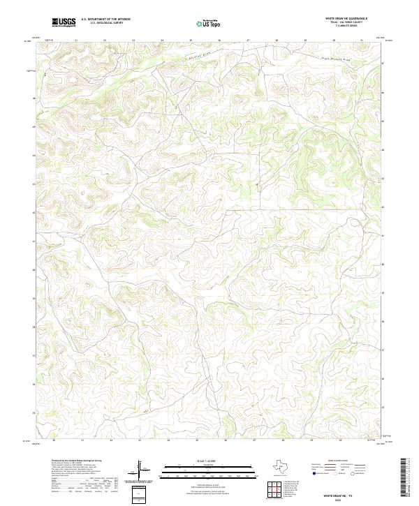
2022 Map of White Draw NE
USGS Topo · Published 2022About this map
Buckley Draw and its drainage network define this expanse of Val Verde County, where the dry washes of the Edwards Plateau cut through high limestone ridges. The landscape is characterized by its intermittent drainage patterns, with South Buckley Draw carving a significant path across the northern reaches before the terrain descends toward the southeast. In the lower corner of the sheet, the winding course of Dolan Cr indicates the natural progression of the local watershed toward the Devils River basin. This 2022 survey, produced by the U.S. Geological Survey, reflects a sparsely populated region of Texas where traditional ranching roads follow the natural contours of the draws, maintaining a land use pattern that has changed little over the decades.
Find a feature on this map
3 named features on this map. Tap any name to fly to it.
Don’t see what you’re looking for? This feature index may not catch every label — zoom into the map to look around manually.
Map Details
Editions of this 2022 White Draw NE Map
This is the sole edition of this map. No revisions or reprints were ever made.
Other maps of this area

1954 · Sonora
USGS Topo · 1:250,000

1958 · Sonora
USGS Topo · 1:250,000

1967 · Dunbar Draw SW
USGS Topo · 1:24,000

1967 · Flat Rock Draw SE
USGS Topo · 1:24,000

1967 · Flat Rock Draw SW
USGS Topo · 1:24,000

1973 · Turney Draw NW
USGS Topo · 1:24,000

1973 · White Draw NW
USGS Topo · 1:24,000

1973 · Robinson Draw
USGS Topo · 1:24,000

1973 · Four Mills
USGS Topo · 1:24,000
1973 · White Draw NE
USGS Topo · 1:24,000