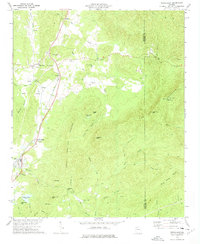
1972 Map of White East
USGS Topo · Published 1975About this map
The Louisville and Nashville railroad corridor anchors the western valley of this landscape, connecting the small communities of Rydal and Pine Log during the early 1970s. The area is characterized by a high density of rural spiritual and educational landmarks, including Fairview Ch, New Hope Ch, and Millers Chapel, alongside the Hickory Log Vocational Sch. Settlement patterns follow the lowlands between the significant rises of Pine Log Mountain and Little Pine Log Mountain.
Find a feature on this map
64 named features on this map. Tap any name to fly to it.
Don’t see what you’re looking for? This feature index may not catch every label — zoom into the map to look around manually.
Map Details
Editions of this 1972 White East Map
2 editions found
Other maps of this area

1890 · Cartersville
USGS Topo · 1:125,000

1891 · Cartersville
USGS Topo · 1:125,000

1896 · Cartersville
USGS Topo · 1:125,000

1906 · Stilesboro
USGS Topo · 1:62,500

1907 · Acworth
USGS Topo · 1:62,500

1908 · Stilesboro
USGS Topo · 1:62,500

1909 · Acworth
USGS Topo · 1:62,500

1941 · Adairsville
USGS Topo · 1:62,500

1944 · Adairsville
USGS Topo · 1:62,500

1947 · Waleska
USGS Topo · 1:62,500