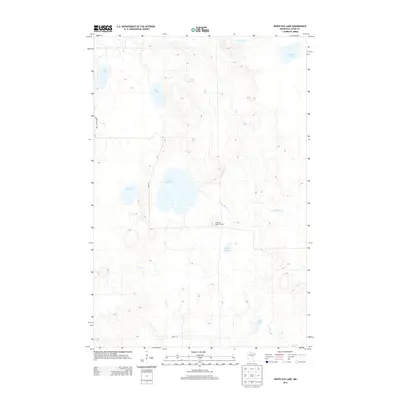
2013 Map of White Elk Lake
USGS Topo · Published 2013About this map
The White Elk Lookout Tower stands as a prominent landmark in this glacial landscape of central Minnesota, overlooking a complex network of wetlands and water bodies. This 2013 survey illustrates the dense concentration of lakes and basins characteristic of Aitkin County, with White Elk Lake at its center. The area is defined by its water resources, from the winding path of the Moose River in the north to isolated features like Kingsleys Pothole. Road development is sparse, primarily consisting of local routes like 540th Ln and the Grant-In-Aid Trl, suggesting a landscape largely dedicated to conservation or forestry. For researchers and outdoorsmen, the map documents a specific moment in the hydrologic history of the region, tracing the drainage of White Elk Cr through the surrounding terrain.
Find a feature on this map
15 named features on this map. Tap any name to fly to it.
Don’t see what you’re looking for? This feature index may not catch every label — zoom into the map to look around manually.
Map Details
Editions of this 2013 White Elk Lake Map
This is the sole edition of this map. No revisions or reprints were ever made.
Other maps of this area

1913 · Cuyuna
USGS Topo · 1:62,500

1914 · Aitkin
USGS Topo · 1:62,500

1915 · Aitkin
USGS Topo · 1:62,500

1915 · Cuyuna
USGS Topo · 1:62,500

1953 · Duluth
USGS Topo · 1:250,000

1958 · Duluth
USGS Topo · 1:250,000

1970 · Edna Lake
USGS Topo · 1:24,000

1970 · Shovel Lake
USGS Topo · 1:24,000

1970 · Bain
USGS Topo · 1:24,000
1970 · Hill City
USGS Topo · 1:24,000