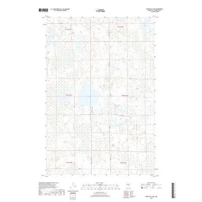
2019 Map of White Elk Lake
USGS Topo · Published 2019About this map
White Elk Lake sits at the heart of this Aitkin County landscape, defined by a complex network of wetlands and glacial lakes. In 2019, the area remains largely undeveloped, characterized by seasonal access routes such as Pub Water Access Rd and county thoroughfares like Co Rd 68. The drainage pattern is led by the White Elk Cr, which flows eastward through the marshy terrain toward Kingsleys Pothole. Further north, the Moose River meanders toward Moose Lake, illustrating the water-rich topography of northern Minnesota. This survey provides a clear view of the public land survey system grid, with boundaries for t50n r27w and neighboring townships clearly delineated against the scattered lakes, including Buss Lake, Wolf Lake, and Otter Lake.
Find a feature on this map
24 named features on this map. Tap any name to fly to it.
Don’t see what you’re looking for? This feature index may not catch every label — zoom into the map to look around manually.
Map Details
Editions of this 2019 White Elk Lake Map
This is the sole edition of this map. No revisions or reprints were ever made.
Other maps of this area

1913 · Cuyuna
USGS Topo · 1:62,500

1914 · Aitkin
USGS Topo · 1:62,500

1915 · Aitkin
USGS Topo · 1:62,500

1915 · Cuyuna
USGS Topo · 1:62,500

1953 · Duluth
USGS Topo · 1:250,000

1958 · Duluth
USGS Topo · 1:250,000

1970 · Edna Lake
USGS Topo · 1:24,000

1970 · Shovel Lake
USGS Topo · 1:24,000

1970 · Bain
USGS Topo · 1:24,000
1970 · Hill City
USGS Topo · 1:24,000