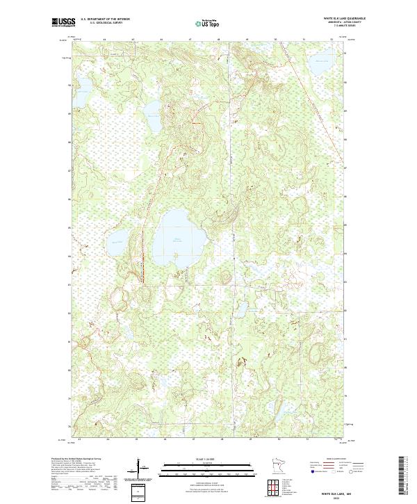
2022 Map of White Elk Lake
USGS Topo · Published 2022About this map
White Elk Lake sits at the heart of this Aitkin County landscape, where glacial depressions and interconnected wetlands dictate the pattern of human access. The area is defined by its numerous water bodies, including Moose Lake and Wolf Lake to the north, which are linked by a network of recreational and seasonal corridors like the Sno Line North: Aitkin Trl. These trails, along with the Blind Lake Trl, reflect the region's importance for timber management and outdoor recreation within the Aitkin County forest lands.
Find a feature on this map
27 named features on this map. Tap any name to fly to it.
Don’t see what you’re looking for? This feature index may not catch every label — zoom into the map to look around manually.
Map Details
Editions of this 2022 White Elk Lake Map
This is the sole edition of this map. No revisions or reprints were ever made.
Other maps of this area

1913 · Cuyuna
USGS Topo · 1:62,500

1914 · Aitkin
USGS Topo · 1:62,500

1915 · Aitkin
USGS Topo · 1:62,500

1915 · Cuyuna
USGS Topo · 1:62,500

1953 · Duluth
USGS Topo · 1:250,000

1958 · Duluth
USGS Topo · 1:250,000

1970 · Edna Lake
USGS Topo · 1:24,000

1970 · Shovel Lake
USGS Topo · 1:24,000

1970 · Bain
USGS Topo · 1:24,000
1970 · Hill City
USGS Topo · 1:24,000