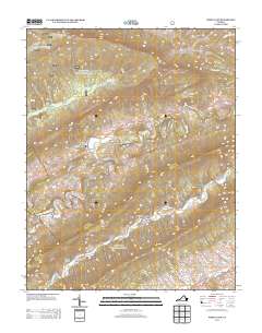
2013 Map of White Gate
USGS Topo · Published 2013About this map
Walker Cr defines the central valley of this Appalachian landscape, winding through a corridor where historical rural routes like Old Mill Dam Rd and Old Church Rd meet. The settlement of White Gate serves as a local hub, situated just north of the notable Flat Hollow. To the south, Alum Springs and the nearby Silver Mine Hollow and Sulphur Hollow suggest a history of mineral interests and local industry tucked into the ridgelines. High elevations are punctuated by landmarks of forest management and recreation, including the Dismal Peak Fire Tower on Sugar Run Mountain and the Honey Spring Patrol Cabin near Big Horse Gap. The map details a transition from traditional agricultural holdings, such as the Farmer Back Creek Farm, to the protected lands of the national forest system, evidenced by the presence of the Wapiti Shelter along Dismal Cr.
Find a feature on this map
39 named features on this map. Tap any name to fly to it.
Don’t see what you’re looking for? This feature index may not catch every label — zoom into the map to look around manually.
Map Details
Editions of this 2013 White Gate Map
This is the sole edition of this map. No revisions or reprints were ever made.
Other maps of this area

1890 · Dublin
USGS Topo · 1:125,000

1891 · Dublin
USGS Topo · 1:125,000

1913 · Peterstown
USGS Topo · 1:48,000

1916 · Peterstown
USGS Topo · 1:62,500

1923 · Pearisburg
USGS Topo · 1:62,500

1925 · Peterstown
USGS Topo · 1:62,500

1932 · Peterstown
USGS Topo · 1:48,000

1932 · Pearisburg
USGS Topo · 1:48,000

1934 · Pulaski
USGS Topo · 1:48,000

1937 · Pearisburg
USGS Topo · 1:62,500