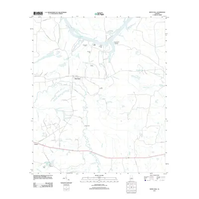
2011 Map of White Hall
USGS Topo · Published 2011About this map
The Alabama River floodplain and its intricate backwater systems define this landscape in Lowndes County. Along the southern banks of the river, Gun Island Chute and Blue Bluff mark a transition from the water's edge to the inland settlements of White Hall and Trickem. The geography is shaped by numerous water bodies including Big Swamp Creek and Cypress Creek, which meander through a network of local roads like Jones Bluff Rd and White Hall Rd.
Find a feature on this map
57 named features on this map. Tap any name to fly to it.
Don’t see what you’re looking for? This feature index may not catch every label — zoom into the map to look around manually.
Map Details
Editions of this 2011 White Hall Map
This is the sole edition of this map. No revisions or reprints were ever made.
Other maps of this area

1953 · Montgomery
USGS Topo · 1:250,000

1956 · Montgomery
USGS Topo · 1:250,000

1957 · Montgomery
USGS Topo · 1:250,000

1957 · Autaugaville
USGS Topo · 1:62,500

1957 · Benton
USGS Topo · 1:62,500

1957 · Braggs
USGS Topo · 1:62,500

1975 · Benton SE
USGS Topo · 1:24,000

1975 · Autaugaville SW
USGS Topo · 1:24,000

1975 · Autaugaville SE
USGS Topo · 1:24,000
1975 · Benton NE
USGS Topo · 1:24,000