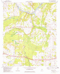
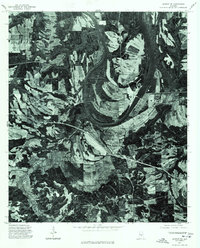
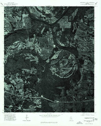
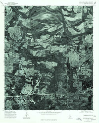
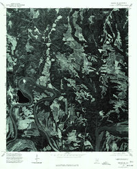
1982 Map of White Hall
USGS Topo · Published 1982About this map
Jones Bluff Lake and the Alabama River dominate the northern landscape of this Lowndes County survey, where the river's winding course creates the prominent Dutch Bend. The area reflects a rural economy shaped by both its water access and its rail connections, with the Western Railway of Alabama cutting through the center of the quadrangle near White Hall. Local history is deeply etched into the land through numerous family and community landmarks, including the Hall Cem, Mitchell Cem, and McGill Cem.
Find a feature on this map
39 named features on this map. Tap any name to fly to it.
Don’t see what you’re looking for? This feature index may not catch every label — zoom into the map to look around manually.
Map Details
Editions of this 1982 White Hall Map
This is the sole edition of this map. No revisions or reprints were ever made.
Other maps of this area

1953 · Montgomery
USGS Topo · 1:250,000

1956 · Montgomery
USGS Topo · 1:250,000

1957 · Montgomery
USGS Topo · 1:250,000
1957 · Autaugaville
USGS Topo · 1:62,500
1957 · Benton
USGS Topo · 1:62,500
1957 · Braggs
USGS Topo · 1:62,500
1975 · Benton SE
USGS Topo · 1:24,000
1975 · Autaugaville SW
USGS Topo · 1:24,000
1975 · Autaugaville SE
USGS Topo · 1:24,000
1975 · Benton NE
USGS Topo · 1:24,000