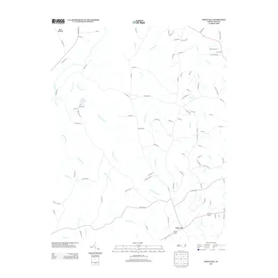
2013 Map of White Hill
USGS Topo · Published 2013About this map
White Hill and the surrounding Moore County landscape are defined by a complex network of waterways that flow toward the Deep River, which cuts across the northwestern corner of this map. The drainage patterns here are remarkably intricate, with Big Governors Cr and Little Governors Cr winding through the central and southern sections, while Little Pocket Cr and Pocket Cr dominate the eastern reaches.
Find a feature on this map
92 named features on this map. Tap any name to fly to it.
Don’t see what you’re looking for? This feature index may not catch every label — zoom into the map to look around manually.
Map Details
Editions of this 2013 White Hill Map
This is the sole edition of this map. No revisions or reprints were ever made.
Other maps of this area

1953 · Raleigh
USGS Topo · 1:250,000

1954 · Raleigh
USGS Topo · 1:250,000

1957 · Murchisontown
USGS Topo · 1:24,000

1970 · Goldston
USGS Topo · 1:24,000

1970 · Colon
USGS Topo · 1:24,000

1970 · Bear Creek
USGS Topo · 1:24,000
1974 · Carthage
USGS Topo · 1:24,000

1974 · White Hill
USGS Topo · 1:24,000
1974 · Vass
USGS Topo · 1:24,000

1974 · Putnam
USGS Topo · 1:24,000