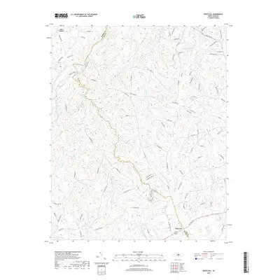
2019 Map of White Hill
USGS Topo · Published 2019About this map
Haw Branch and White Hill anchor this rural landscape along the border of Moore and Lee Counties in the late 2010s. The northern reaches are defined by the winding course of the Deep River, while a dense network of creeks including Big Governors Cr and McIntosh Cr drain the central and southern terrain. This survey reflects a modern mix of traditional land use and newer recreational developments, visible in the presence of Race Loop and Challenge Loop near Little Governors Cr.
Find a feature on this map
82 named features on this map. Tap any name to fly to it.
Don’t see what you’re looking for? This feature index may not catch every label — zoom into the map to look around manually.
Map Details
Editions of this 2019 White Hill Map
This is the sole edition of this map. No revisions or reprints were ever made.
Other maps of this area

1953 · Raleigh
USGS Topo · 1:250,000

1954 · Raleigh
USGS Topo · 1:250,000

1957 · Murchisontown
USGS Topo · 1:24,000

1970 · Goldston
USGS Topo · 1:24,000

1970 · Colon
USGS Topo · 1:24,000

1970 · Bear Creek
USGS Topo · 1:24,000
1974 · Carthage
USGS Topo · 1:24,000

1974 · White Hill
USGS Topo · 1:24,000
1974 · Vass
USGS Topo · 1:24,000

1974 · Putnam
USGS Topo · 1:24,000