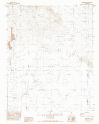
1983 Map of White Hills
USGS Topo · Published 1983About this map
The Naval Weapons Center dominates this high desert landscape in the early 1980s, serving as a specialized military testing ground where the geography of China Lake Valley and Indian Wells meets defense technology. The terrain is strictly partitioned by specialized infrastructure, including several Flight Lines, a dedicated Missile Line, and multiple Target Areas scattered across the basin. Localized features such as a Launch Pad, a Bunker, and various Targets illustrate the active military usage of the era. Positioned at the intersection of Inyo, Kern, and San Bernardino counties, the map also captures the natural relief of the White Hills and a solitary Spring, providing a sharp contrast between the arid desert environment and the sophisticated technological operations conducted within these boundaries.
Find a feature on this map
16 named features on this map. Tap any name to fly to it.
Don’t see what you’re looking for? This feature index may not catch every label — zoom into the map to look around manually.
Map Details
Editions of this 1983 White Hills Map
This is the sole edition of this map. No revisions or reprints were ever made.
Other maps of this area

1915 · Searles Lake
USGS Topo · 1:250,000

1943 · Inyokern
USGS Topo · 1:62,500

1947 · Trona
USGS Topo · 1:250,000

1948 · Trona
USGS Topo · 1:250,000

1953 · Mountain Springs Canyon
USGS Topo · 1:62,500

1953 · Ridgecrest
USGS Topo · 1:62,500

1953 · Trona
USGS Topo · 1:250,000

1954 · Little Lake
USGS Topo · 1:62,500

1957 · Trona
USGS Topo · 1:250,000

1960 · Trona
USGS Topo · 1:250,000