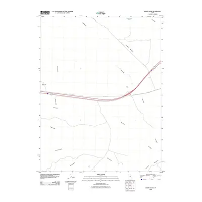
2010 Map of White House
USGS Topo · Published 2010About this map
White House sits at the heart of this Grand County landscape, where the high desert terrain is defined by a dense network of drainage systems. The map illustrates how transportation routes like Old Hwy Cisco and Windy Mesa Rd navigate the natural topography of Windy Mesa and Elba Flat. A striking number of ephemeral watercourses, including Nash Wash, Cisco Wash, and Sagers Wash, carve through the earth, converging near the central settlement area. The presence of Dead Sheep Pond to the north and various named washes such as Pinto Wash, Monument Wash, and Dugout Wash highlights the reliance on specific water features and erosion patterns for navigation in this arid region of eastern Utah. This survey documents the intersection of modern infrastructure and traditional travel paths against a backdrop of complex geological runoff.
Find a feature on this map
14 named features on this map. Tap any name to fly to it.
Don’t see what you’re looking for? This feature index may not catch every label — zoom into the map to look around manually.
Map Details
Editions of this 2010 White House Map
This is the sole edition of this map. No revisions or reprints were ever made.
Other maps of this area

1885 · East Tavaputs
USGS Topo · 1:250,000

1885 · La Sal
USGS Topo · 1:250,000

1955 · Mt. Waas 2 SE
USGS Topo · 1:24,000

1956 · Moab
USGS Topo · 1:250,000

1956 · Grand Junction
USGS Topo · 1:250,000

1958 · Thompson
USGS Topo · 1:62,500

1958 · Cisco
USGS Topo · 1:62,500

1959 · Grand Junction
USGS Topo · 1:250,000

1959 · Moab
USGS Topo · 1:250,000

1960 · Moab
USGS Topo · 1:250,000