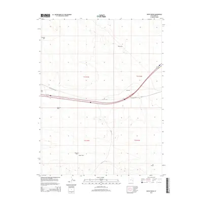
2014 Map of White House
USGS Topo · Published 2014About this map
White House and the surrounding high desert of Grand County are defined by a complex network of seasonal drainages and dry washes that slice through the Mancos Desert Central. This 2014 survey captures a landscape where modern transportation corridors parallel historic routes, most notably the Old Cisco Hwy which traverses the center of the quadrangle. The terrain rises to landmarks like Windy Mesa and levels out across the broad Elba Flat, while the underlying geology is marked by the erosive paths of Saleratus Wash, Monument Wash, and Dugout Wash. These watercourses, including the curiously named Yellow Cat and San Arroyo, illustrate the hydraulic patterns of this arid region, providing a detailed record for those studying the physical geography and road evolution of eastern Utah.
Find a feature on this map
14 named features on this map. Tap any name to fly to it.
Don’t see what you’re looking for? This feature index may not catch every label — zoom into the map to look around manually.
Map Details
Editions of this 2014 White House Map
This is the sole edition of this map. No revisions or reprints were ever made.
Other maps of this area

1885 · East Tavaputs
USGS Topo · 1:250,000

1885 · La Sal
USGS Topo · 1:250,000

1955 · Mt. Waas 2 SE
USGS Topo · 1:24,000

1956 · Moab
USGS Topo · 1:250,000

1956 · Grand Junction
USGS Topo · 1:250,000

1958 · Thompson
USGS Topo · 1:62,500

1958 · Cisco
USGS Topo · 1:62,500

1959 · Grand Junction
USGS Topo · 1:250,000

1959 · Moab
USGS Topo · 1:250,000

1960 · Moab
USGS Topo · 1:250,000