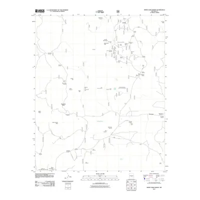
2011 Map of White Oaks North
USGS Topo · Published 2011About this map
The Jicarilla Mountains dominate the landscape of this 2011 survey, centered on the high-desert mining and ranching legacies of Lincoln County. The settlement of Jicarilla serves as a focal point, supported by the Jicarilla School and the Jicarilla Cemetery. The region’s industrial history is deeply etched into the terrain, with a high concentration of mineral workings including the Lucky Strike Mine, Black Gold Mine, and the Magnetite Iron Lode.
Find a feature on this map
75 named features on this map. Tap any name to fly to it.
Don’t see what you’re looking for? This feature index may not catch every label — zoom into the map to look around manually.
Map Details
Editions of this 2011 White Oaks North Map
This is the sole edition of this map. No revisions or reprints were ever made.
Other maps of this area

1934 · Capitan
USGS Topo · 1:48,000

1937 · Capitan
USGS Topo · 1:62,500

1938 · Carrizozo
USGS Topo · 1:48,000

1943 · Carrizozo
USGS Topo · 1:62,500

1950 · Carrizozo
USGS Topo · 1:62,500

1950 · Little Black Peak
USGS Topo · 1:62,500

1955 · Roswell
USGS Topo · 1:250,000

1958 · Roswell
USGS Topo · 1:250,000

1962 · Roswell
USGS Topo · 1:250,000

1973 · Ancho
USGS Topo · 1:24,000