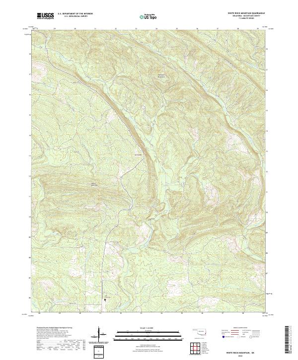
2022 Map of White Rock Mountain
USGS Topo · Published 2022About this map
The Boktuklo Mountains dominate this McCurtain County landscape, where deep drainages and ridges define the character of southeastern Oklahoma. The E Fork Glover River winds through the central valley, joined by tributaries such as Dog Cr and Coon Cr. Settlement is sparse in this timbered terrain, though the Kulli-Chito Cem near the southern boundary serves as a significant genealogical landmark for those tracing local family roots. A network of primitive paths, including the Wild Horse Boktuklo Trl and World Horse Trl, suggests a history of backcountry travel through the high ground of Spring Mtn and White Rock Mtn. The southern portion of the map transitions toward more developed routes like Battiest Rd, reflecting the edge of the mountain wilderness as it meets the local road systems.
Find a feature on this map
21 named features on this map. Tap any name to fly to it.
Don’t see what you’re looking for? This feature index may not catch every label — zoom into the map to look around manually.
Map Details
Editions of this 2022 White Rock Mountain Map
This is the sole edition of this map. No revisions or reprints were ever made.
Other maps of this area

1900 · Winding Stair
USGS Topo · 1:125,000

1902 · Lukfata
USGS Topo · 1:125,000

1909 · Winding Stair
USGS Topo · 1:125,000

1950 · Mcalester
USGS Topo · 1:250,000

1959 · Page
USGS Topo · 1:62,500

1960 · Bethel
USGS Topo · 1:62,500

1960 · Smithville
USGS Topo · 1:62,500

1962 · McAlester
USGS Topo · 1:250,000

1965 · McAlester
USGS Topo · 1:250,000
1966 · Honobia
USGS Topo · 1:24,000