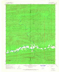
1966 Map of Honobia
USGS Topo · Published 1967About this map
The mountain settlement of Honobia lies at the intersection of several significant ridgelines in the mid-1960s, serving as a remote hub where the Honobia Sch and a local Cem mark the community's center. This landscape is defined by the high elevations of Kiamichi Mountain to the north and the Boktuklo Mountains to the south, with the Little River winding through the valley floor. Transportation in this era is characterized by rugged access, including the Indian Highway, the Turney Ranch Trail, and numerous unnamed jeep trails. A Landing Strip and the Christs Forty Acres Camp highlight specialized land uses in the valley. The map also records the W Horse Base Line, a critical surveying marker that transects the Sulphur Mountains in the southern portion of the quadrangle.
Find a feature on this map
39 named features on this map. Tap any name to fly to it.
Don’t see what you’re looking for? This feature index may not catch every label — zoom into the map to look around manually.
Map Details
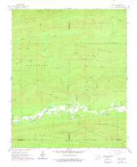
Editions of this 1966 Honobia Map
2 editions found
Other maps of this area

1900 · Winding Stair
USGS Topo · 1:125,000

1901 · Tuskahoma
USGS Topo · 1:125,000

1901 · Alikchi
USGS Topo · 1:125,000

1902 · Lukfata
USGS Topo · 1:125,000

1908 · Tuskahoma
USGS Topo · 1:125,000

1909 · Tuskahoma
USGS Topo · 1:125,000

1909 · Winding Stair
USGS Topo · 1:125,000

1950 · Mcalester
USGS Topo · 1:250,000

1960 · Bethel
USGS Topo · 1:62,500

1962 · McAlester
USGS Topo · 1:250,000