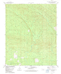
1982 Map of White Rock Mountain
USGS Topo · Published 1983About this map
Spring Mountain and the Boktuklo Mountains dominate this McCurtain County landscape, where the terrain is carved by the East Fork Glover River and Boktuklo Creek. The map records a quiet rural community centered around the settlement of Carpenter in the southern portion of the quadrangle. Local life is anchored by gathering places such as Kullichito Ch and Cumberland Ch, while the presence of a Shale Pit indicates small-scale industrial activity. Numerous watercourses, including Dog Cr, Coon Creek, and Blue Creek, weave through the high ridges. This 1980s survey detail offers a clear view of the road network and field lines connecting these remote upland sites before modern shifts in land use or reforestation occurred.
Find a feature on this map
17 named features on this map. Tap any name to fly to it.
Don’t see what you’re looking for? This feature index may not catch every label — zoom into the map to look around manually.
Map Details
Editions of this 1982 White Rock Mountain Map
This is the sole edition of this map. No revisions or reprints were ever made.
Other maps of this area

1900 · Winding Stair
USGS Topo · 1:125,000

1902 · Lukfata
USGS Topo · 1:125,000

1909 · Winding Stair
USGS Topo · 1:125,000

1950 · Mcalester
USGS Topo · 1:250,000

1959 · Page
USGS Topo · 1:62,500

1960 · Bethel
USGS Topo · 1:62,500

1960 · Smithville
USGS Topo · 1:62,500

1962 · McAlester
USGS Topo · 1:250,000

1965 · McAlester
USGS Topo · 1:250,000
1966 · Honobia
USGS Topo · 1:24,000