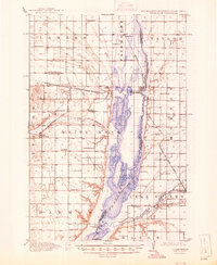
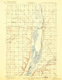
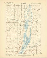
1918 Map of White Rock
USGS Topo · Published 1946About this map
Lake Traverse and the Bois de Sioux River dominate this tri-state borderland where South Dakota, Minnesota, and North Dakota converge. The 1915 survey captures a landscape structured by rural township schools and early rail expansion, including the Chicago Milwaukee and St Paul and the Minneapolis Sault Ste Marie and Atlantic. The northern boundary of the Sisseton and Wahpeton Indian Reservation cuts through the center of the sheet, defining land use patterns near Rosholt and White Rock. A dense network of local education is evident through family-named institutions like Knutson School, Teare School, and Norburg School. The eastern portion of the map shows the meandering Mustinka River feeding into the lake near the Wheaton settlement, illustrating the importance of these water systems to early regional development.
Find a feature on this map
45 named features on this map. Tap any name to fly to it.
Don’t see what you’re looking for? This feature index may not catch every label — zoom into the map to look around manually.
Map Details
Editions of this 1918 White Rock Map
4 editions found

Historical Maps of Wheaton Through Time

Featured Locations
- Wheaton, MN
- Lake Traverse District, SD
- White Rock, SD
- LaMars Township, ND
- Rosholt, Lake Traverse District