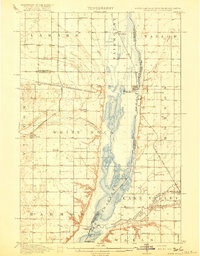
1918 Map of White Rock
USGS Topo · Published 1918About this map
Lake Traverse and the Bois de Sioux River anchor this 1915 survey of the tri-state border region where South Dakota, North Dakota, and Minnesota converge. The landscape is a testament to the early 20th-century agrarian settlement, marked by an exceptionally dense grid of rural schools like the Teare School, Knutson School, and Moreland School. These one-room schoolhouses served the families farming the expansive flats between the Big Slough and the Mustinka River.
Find a feature on this map
46 named features on this map. Tap any name to fly to it.
Don’t see what you’re looking for? This feature index may not catch every label — zoom into the map to look around manually.
Map Details
Editions of this 1918 White Rock Map
4 editions found
Other maps of this area

1904 · Wahpeton
USGS Topo · 1:125,000

1915 · White Rock
USGS Topo · 1:62,500

1916 · Peever
USGS Topo · 1:62,500

1916 · Beardsley
USGS Topo · 1:62,500

1917 · New Effington
USGS Topo · 1:62,500

1918 · Peever
USGS Topo · 1:62,500

1918 · White Rock
USGS Topo · 1:62,500

1918 · Beardsley
USGS Topo · 1:62,500

1950 · Graceville
USGS Topo · 1:62,500

1951 · Wheaton
USGS Topo · 1:62,500