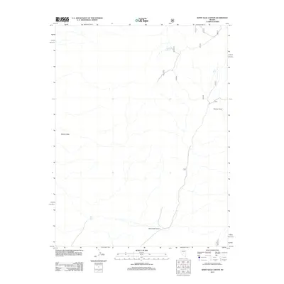
2012 Map of White Sage Canyon
USGS Topo · Published 2012About this map
Monitor Valley provides the broad western backdrop for this desert landscape, where the terrain rises sharply toward the eastern peaks of the Monitor Range. The map documents a sparsely populated corridor of central Nevada, characterized by dry drainages and the essential locations of isolated water sources such as South Brock Spring, Goat Spring, and White Sage Spring. These points of reliable water have historically dictated movement and survival in the high desert.
Find a feature on this map
12 named features on this map. Tap any name to fly to it.
Don’t see what you’re looking for? This feature index may not catch every label — zoom into the map to look around manually.
Map Details
Editions of this 2012 White Sage Canyon Map
This is the sole edition of this map. No revisions or reprints were ever made.
Other maps of this area

1926 · Roberts Mountains
USGS Topo · 1:250,000

1929 · Roberts Mountains
USGS Topo · 1:250,000

1955 · Millett
USGS Topo · 1:250,000

1956 · Horse Heaven Mtn
USGS Topo · 1:62,500

1956 · Antelope Peak
USGS Topo · 1:62,500

1959 · Millett
USGS Topo · 1:250,000

1960 · Hickison Summit
USGS Topo · 1:62,500

1960 · Dianas Punch Bowl
USGS Topo · 1:62,500

1978 · Summit Mountain
USGS Topo · 1:100,000
1989 · Dianas Punch Bowl
USGS Topo · 1:24,000