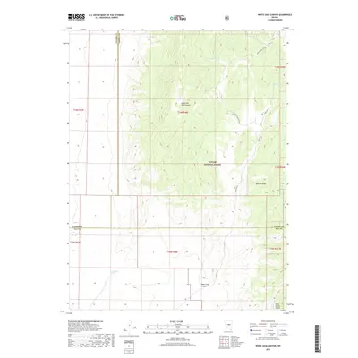
2018 Map of White Sage Canyon
USGS Topo · Published 2018About this map
Toiyabe National Forest encompasses the high-elevation terrain of this Nevada interior, where the Monitor Range defines the eastern verticality of the landscape. This 2018 survey documents a remote watershed characterized by complex drainage systems including South Brock Canyon and the South Fork Brock Canyon. The map reveals a land shaped by scarce water sources, marking essential hydration points such as South Brock Spring and Goat Spring that have long dictated movement through these high basins. Toward the south, the topography transitions into the steep corridors of White Sage Canyon and Horse Heaven Canyon. This document illustrates the intersection of three counties—Lander, Eureka, and Nye—placing the viewer at a literal and metaphorical corner of the Great Basin wilderness.
Find a feature on this map
20 named features on this map. Tap any name to fly to it.
Don’t see what you’re looking for? This feature index may not catch every label — zoom into the map to look around manually.
Map Details
Editions of this 2018 White Sage Canyon Map
This is the sole edition of this map. No revisions or reprints were ever made.
Other maps of this area

1926 · Roberts Mountains
USGS Topo · 1:250,000

1929 · Roberts Mountains
USGS Topo · 1:250,000

1955 · Millett
USGS Topo · 1:250,000

1956 · Horse Heaven Mtn
USGS Topo · 1:62,500

1956 · Antelope Peak
USGS Topo · 1:62,500

1959 · Millett
USGS Topo · 1:250,000

1960 · Hickison Summit
USGS Topo · 1:62,500

1960 · Dianas Punch Bowl
USGS Topo · 1:62,500

1978 · Summit Mountain
USGS Topo · 1:100,000
1989 · Dianas Punch Bowl
USGS Topo · 1:24,000