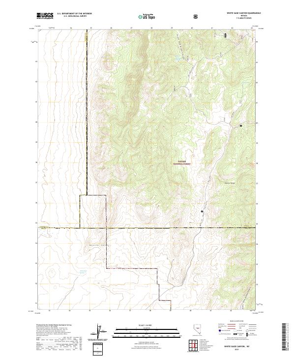
2021 Map of White Sage Canyon
USGS Topo · Published 2021About this map
Toiyabe National Forest lands dominate the high-elevation landscape of central Nevada in this 2021 survey, where the rugged Monitor Range transitions into the broad expanse of Monitor Valley. This map captures a remote section of the Great Basin where Lander, Eureka, and Nye Counties meet, centered on the drainage systems of White Sage Canyon and Horse Heaven Canyon. The terrain is defined by seasonal water sources such as Goat Spring and South Brock Spring, which have long been vital markers for livestock and land management in this arid interior. The transition from the steep grades of South Fork Brock Canyon to the valley floor reflects the classic basin-and-range topography that dictated the movement of early ranchers and mineral prospectors through this portion of the Toiyabe range.
Find a feature on this map
20 named features on this map. Tap any name to fly to it.
Don’t see what you’re looking for? This feature index may not catch every label — zoom into the map to look around manually.
Map Details
Editions of this 2021 White Sage Canyon Map
This is the sole edition of this map. No revisions or reprints were ever made.
Other maps of this area

1926 · Roberts Mountains
USGS Topo · 1:250,000

1929 · Roberts Mountains
USGS Topo · 1:250,000

1955 · Millett
USGS Topo · 1:250,000

1956 · Horse Heaven Mtn
USGS Topo · 1:62,500

1956 · Antelope Peak
USGS Topo · 1:62,500

1959 · Millett
USGS Topo · 1:250,000

1960 · Hickison Summit
USGS Topo · 1:62,500

1960 · Dianas Punch Bowl
USGS Topo · 1:62,500

1978 · Summit Mountain
USGS Topo · 1:100,000
1989 · Dianas Punch Bowl
USGS Topo · 1:24,000