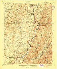
1923 Map of White Sulphur Springs
USGS Topo · Published 1923About this map
Lewisburg and the surrounding Greenbrier Valley are depicted here just as the modern highway system began to overlay older routes like the James River and Kanawha Turnpike. The landscape is defined by the winding path of the Greenbrier River, which served as a vital corridor for the Chesapeake and Ohio railroad. This 1920s survey captures a dense network of rural infrastructure, including numerous one-room schoolhouses like Arbuckle School and Dansie School, alongside communal gathering places such as Walnut Grove Church. In the eastern section, the famous resort area of White Sulphur Springs is shown in detail, situated beneath the heights of Kates Mountain. This map provides a valuable record for genealogists, showing the exact placement of vanished post offices and stations like Falling Springs Remick PO and Sta and Judyton PO Keister Sta, which once anchored small mountain communities.
Find a feature on this map
93 named features on this map. Tap any name to fly to it.
Don’t see what you’re looking for? This feature index may not catch every label — zoom into the map to look around manually.
Map Details
Editions of this 1923 White Sulphur Springs Map
3 editions found

Other maps of this area

1887 · Hinton
USGS Topo · 1:125,000

1887 · Lewisburg
USGS Topo · 1:125,000

1889 · Nicholas
USGS Topo · 1:125,000

1891 · Lewisburg
USGS Topo · 1:125,000

1891 · Nicholas
USGS Topo · 1:125,000

1891 · Huntersville
USGS Topo · 1:125,000

1892 · Hinton
USGS Topo · 1:125,000

1894 · Huntersville
USGS Topo · 1:125,000

1901 · Nicholas
USGS Topo · 1:125,000

1918 · Richwood
USGS Topo · 1:62,500