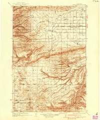
1937 Map of White Swan
USGS Topo · Published 1937About this map
Fort Simcoe stands as a central landmark within the Yakima Indian Reservation, anchoring a landscape defined by the transition from the high ridges of Ahtanum Ridge and Yakima Ridge to the irrigated agricultural lands of the Yakima Valley. The 1934 survey highlights an evolving water management system, tracing the path of the Pump Canal and various laterals that supported the growing settlements of White Swan, Brownstown, and Harrah.
Find a feature on this map
57 named features on this map. Tap any name to fly to it.
Don’t see what you’re looking for? This feature index may not catch every label — zoom into the map to look around manually.
Map Details
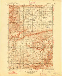
Editions of this 1937 White Swan Map
3 editions found

Other maps of this area

1899 · Ellensburg
USGS Topo · 1:125,000

1901 · Ellensburg
USGS Topo · 1:125,000

1902 · Mount Aix
USGS Topo · 1:125,000

1904 · Mt Aix
USGS Topo · 1:125,000

1904 · Mount Adams
USGS Topo · 1:125,000

1907 · Mount Adams
USGS Topo · 1:125,000

1910 · Zillah
USGS Topo · 1:125,000

1916 · Arlington
USGS Topo · 1:125,000

1934 · The Dalles
USGS Topo · 1:125,000

1936 · Yakima East
USGS Topo · 1:48,000