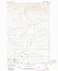
1958 Map of White Swan
USGS Topo · Published 1985About this map
White Swan serves as a central hub within the Yakima Indian Reservation, characterized by a transition from the elevated slopes of the north down to the productive reaches of Olney Flat. The settlement pattern is defined by a rigorous grid of section lines and irrigation works like the Main Canal and Highline Canal, which transformed this arid landscape into a managed agricultural zone. To the west, the presence of Fort Simcoe State Park and the Ranger Sta points to the area's legacy as a site of administrative and military importance.
Find a feature on this map
57 named features on this map. Tap any name to fly to it.
Don’t see what you’re looking for? This feature index may not catch every label — zoom into the map to look around manually.
Map Details
Editions of this 1958 White Swan Map
3 editions found

Other maps of this area

1899 · Ellensburg
USGS Topo · 1:125,000

1901 · Ellensburg
USGS Topo · 1:125,000

1937 · White Swan
USGS Topo · 1:125,000

1950 · Yakima
USGS Topo · 1:250,000

1958 · Toppenish Mtn.
USGS Topo · 1:24,000

1958 · Harrah
USGS Topo · 1:24,000
1958 · Yakima West
USGS Topo · 1:24,000

1958 · Fort Simcoe
USGS Topo · 1:24,000

1958 · Fort Simcoe
USGS Topo · 1:62,500

1958 · Wiley City
USGS Topo · 1:24,000