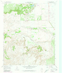
1967 Map of Whiteflat
USGS Topo · Published 1981About this map
The Middle Pease River cuts through this portion of Motley County, shaping a landscape defined by deep draws and isolated peaks. Water management is the central theme of this ranching country, evidenced by the numerous named water sources like Miller Springs Windmill, Stokes Windmill, and Bull Cod Windmill scattered across the terrain. These landmarks, along with Cedar Tank and Hawk Hill Tank, reflect the vital infrastructure required for cattle operations in the Texas Panhandle during the late 1960s.
Find a feature on this map
31 named features on this map. Tap any name to fly to it.
Don’t see what you’re looking for? This feature index may not catch every label — zoom into the map to look around manually.
Map Details
Editions of this 1967 Whiteflat Map
2 editions found
Other maps of this area

1954 · Lubbock
USGS Topo · 1:250,000

1954 · Plainview
USGS Topo · 1:250,000

1958 · Plainview
USGS Topo · 1:250,000

1966 · Matador
USGS Topo · 1:24,000

1967 · Quitaque Peaks
USGS Topo · 1:24,000

1967 · Dick Moore Canyon
USGS Topo · 1:24,000

1967 · Hornica Creek
USGS Topo · 1:24,000

1967 · Flomot
USGS Topo · 1:24,000

1967 · Whiteflat
USGS Topo · 1:24,000

1968 · Mac Bain
USGS Topo · 1:24,000