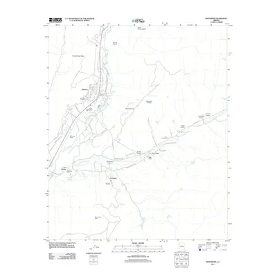
2011 Map of Whiteriver
USGS Topo · Published 2011About this map
The confluence of the North Fork White River and East Fork White River anchors the community of Whiteriver, which serves as a central hub for the surrounding landscape. The town's grid is detailed with residential streets like Penrod Ave and Sycamore ST, alongside the Whiteriver Post Office and Whiteriver Cemetery. The presence of the Whiteriver Airport and the historic site of Fort Apache to the southwest highlights the area's continued administrative and logistical importance.
Find a feature on this map
73 named features on this map. Tap any name to fly to it.
Don’t see what you’re looking for? This feature index may not catch every label — zoom into the map to look around manually.
Map Details
Editions of this 2011 Whiteriver Map
This is the sole edition of this map. No revisions or reprints were ever made.
Other maps of this area

1954 · Clifton
USGS Topo · 1:250,000

1954 · Mesa
USGS Topo · 1:250,000

1957 · Mesa
USGS Topo · 1:250,000

1957 · Clifton
USGS Topo · 1:250,000

1958 · Clifton
USGS Topo · 1:250,000

1958 · Mesa
USGS Topo · 1:250,000

1960 · Mesa
USGS Topo · 1:250,000

1962 · Clifton
USGS Topo · 1:250,000

1964 · Mesa
USGS Topo · 1:250,000
1966 · Round Top Mtn
USGS Topo · 1:24,000