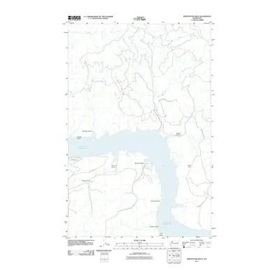
2011 Map of Whitestone Rock
USGS Topo · Published 2011About this map
Franklin D Roosevelt Lake dominates this 2011 survey, illustrating the complex shoreline of the reservoir as it winds through the canyon country of eastern Washington. The land north of the water is situated within the Colville Indian Reservation, where the terrain is marked by steep drainages like Brody Creek and Whitestone Creek. A network of unpaved access routes, including the Ninemile-Hellgate Rd, provides the only passage through this territory.
Find a feature on this map
23 named features on this map. Tap any name to fly to it.
Don’t see what you’re looking for? This feature index may not catch every label — zoom into the map to look around manually.
Map Details
Editions of this 2011 Whitestone Rock Map
This is the sole edition of this map. No revisions or reprints were ever made.
Other maps of this area

1948 · Wilbur
USGS Topo · 1:62,500

1948 · Wilmont Creek
USGS Topo · 1:62,500

1948 · Lincoln
USGS Topo · 1:62,500

1950 · Lincoln
USGS Topo · 1:62,500

1950 · Wilmont Creek
USGS Topo · 1:62,500

1950 · Wilbur
USGS Topo · 1:62,500

1952 · Keller
USGS Topo · 1:62,500

1953 · Ritzville
USGS Topo · 1:250,000

1954 · Okanogan
USGS Topo · 1:250,000

1956 · Wilmont Creek
USGS Topo · 1:62,500