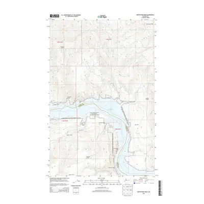
2013 Map of Whitestone Rock
USGS Topo · Published 2013About this map
Franklin D Roosevelt Lake dominates the central landscape of this Lincoln and Ferry County region, where the Columbia River transitions into the expansive waters of the Lake Roosevelt National Recreation Area. The topography is defined by dramatic elevation changes, from the prominent Whitestone Ridge in the northeast to the sheer descent of Hell Gate Canyon. This 2013 survey illustrates a rugged corridor of the Pacific Northwest, where the Colville Indian Reservation meets the northern shoreline. Locally significant landforms such as Whitestone Rock and Hellgate Island provide distinct navigational markers within the reservoir. The map reveals a network of canyons including Penix Canyon and Wynhoff Canyon that drain into the lake, while terrestrial access is maintained by rural routes like Hellgate Rd and Jones Bay Rd N.
Find a feature on this map
28 named features on this map. Tap any name to fly to it.
Don’t see what you’re looking for? This feature index may not catch every label — zoom into the map to look around manually.
Map Details
Editions of this 2013 Whitestone Rock Map
This is the sole edition of this map. No revisions or reprints were ever made.
Other maps of this area

1948 · Wilbur
USGS Topo · 1:62,500

1948 · Wilmont Creek
USGS Topo · 1:62,500

1948 · Lincoln
USGS Topo · 1:62,500

1950 · Lincoln
USGS Topo · 1:62,500

1950 · Wilmont Creek
USGS Topo · 1:62,500

1950 · Wilbur
USGS Topo · 1:62,500

1952 · Keller
USGS Topo · 1:62,500

1953 · Ritzville
USGS Topo · 1:250,000

1954 · Okanogan
USGS Topo · 1:250,000

1956 · Wilmont Creek
USGS Topo · 1:62,500