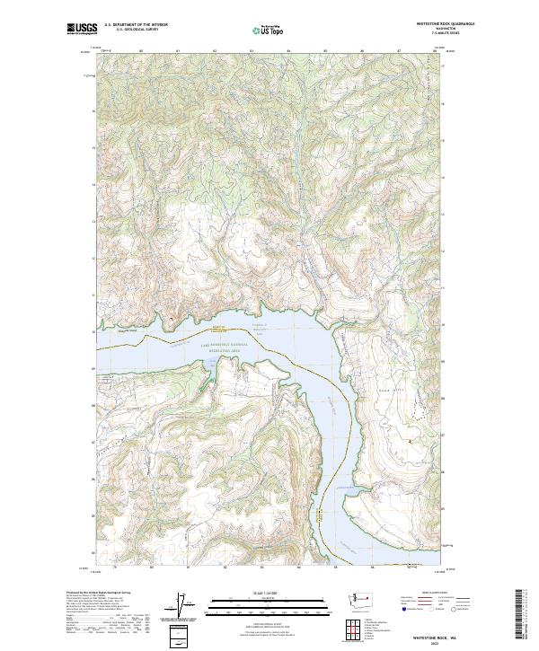
2023 Map of Whitestone Rock
USGS Topo · Published 2023About this map
Franklin D Roosevelt Lake dominates this landscape where the Columbia River carves through the high desert of the Pacific Northwest. Within the Lake Roosevelt National Recreation Area, the topography is defined by dramatic elevation changes and a network of deep-cut drainages such as Hell Gate Canyon, Penix Canyon, and Tamarack Canyon. The map illustrates the rugged boundary between Ferry and Lincoln counties, following the winding path of the submerged river valley. Away from the water, high-elevation features like Whitestone Ridge and the Sand Hills stand above the surrounding plateaus. Local landmarks, including Hellgate Island and the secluded waters of Lundstrom Bay and Moonshine Bay, are accessible via a web of unpaved tracks such as Ninemile-Hellgate Rd and Jones Bay Rd N, highlighting the area's role as a remote outdoor destination.
Find a feature on this map
39 named features on this map. Tap any name to fly to it.
Don’t see what you’re looking for? This feature index may not catch every label — zoom into the map to look around manually.
Map Details
Editions of this 2023 Whitestone Rock Map
This is the sole edition of this map. No revisions or reprints were ever made.
Other maps of this area

1948 · Wilbur
USGS Topo · 1:62,500

1948 · Wilmont Creek
USGS Topo · 1:62,500

1948 · Lincoln
USGS Topo · 1:62,500

1950 · Lincoln
USGS Topo · 1:62,500

1950 · Wilmont Creek
USGS Topo · 1:62,500

1950 · Wilbur
USGS Topo · 1:62,500

1952 · Keller
USGS Topo · 1:62,500

1953 · Ritzville
USGS Topo · 1:250,000

1954 · Okanogan
USGS Topo · 1:250,000

1956 · Wilmont Creek
USGS Topo · 1:62,500