
1971 Map of Whitetail Creek
USGS Topo · Published 1974About this map
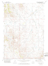
Bishop Ranch Oil Field and the Dillinger Ranch Oil Field define the industrial footprint of this Campbell County landscape in the early 1970s. The terrain is dominated by the winding course of the Belle Fourche River, which is fed by numerous drainages including Whitetail Creek, Little Piney Creek, and Yellow Hammer Creek. Significant topographical features like the Yellow Hammer Buttes and Cabin Canyon provide a backdrop to a network of resource extraction points, indicated by several scattered oil wells and drill holes.
Find a feature on this map
14 named features on this map. Tap any name to fly to it.
Don’t see what you’re looking for? This feature index may not catch every label — zoom into the map to look around manually.
Map Details
Editions of this 1971 Whitetail Creek Map
2 editions found
Other maps of this area

1954 · Gillette
USGS Topo · 1:250,000

1955 · Newcastle
USGS Topo · 1:250,000

1955 · Gillette
USGS Topo · 1:250,000

1958 · Gillette
USGS Topo · 1:250,000

1958 · Newcastle
USGS Topo · 1:250,000

1962 · Gillette
USGS Topo · 1:250,000

1971 · Coyote Draw
USGS Topo · 1:24,000

1971 · Coon Track Creek
USGS Topo · 1:24,000

1971 · Rough Creek
USGS Topo · 1:24,000
1971 · Whitetail Creek SE
USGS Topo · 1:24,000