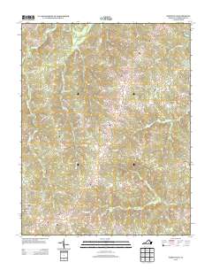
2013 Map of Whiteville
USGS Topo · Published 2013About this map
Willis River flows through the northern reaches of this Cumberland County landscape, anchoring a rural topography defined by small settlements and family-named roads. The area around Whiteville and Ashby is characterized by a network of drainage systems including Bigger Cr and Muddy Cr, which feed into local catchments like Flippen Lake. These watercourses historically influenced the placement of early homesteads and road alignments, such as Toll Gate Forest Trl and Jenkins Ridge Rd.
Find a feature on this map
56 named features on this map. Tap any name to fly to it.
Don’t see what you’re looking for? This feature index may not catch every label — zoom into the map to look around manually.
Map Details
Editions of this 2013 Whiteville Map
This is the sole edition of this map. No revisions or reprints were ever made.
Other maps of this area

1891 · Palmyra
USGS Topo · 1:125,000

1891 · Farmville
USGS Topo · 1:125,000

1893 · Farmville
USGS Topo · 1:125,000

1895 · Palmyra
USGS Topo · 1:125,000

1897 · Palmyra
USGS Topo · 1:125,000

1947 · Roanoke
USGS Topo · 1:250,000

1950 · Dillwyn
USGS Topo · 1:62,500

1958 · Farmville
USGS Topo · 1:62,500

1958 · Jetersville
USGS Topo · 1:62,500

1958 · Dillwyn
USGS Topo · 1:62,500