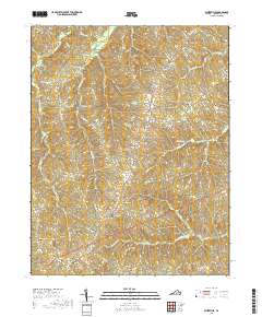
2019 Map of Whiteville
USGS Topo · Published 2019About this map
The Willis River meanders through the northwestern corner of this territory, where the rural crossroads of Whiteville and Ashby anchor the local geography. This central Virginia landscape is characterized by its numerous small burial grounds and family-named landmarks, offering significant value for genealogical research. The map documents scattered settlements like Oak Forest and Clinton, connected by a network of historic routes including Cartersville Rd and Bonbrook Creek Rd. Water features such as Flippen Lake and Fleming Lake punctuate the drainage basins of Muddy Creek and Maxey Mill Creek. The high concentration of cemeteries, from Thomas Chapel Cem to the south-lying Hendricks Cem, suggests a long-established pattern of small-scale agricultural communities and family farmsteads typical of the Piedmont region.
Find a feature on this map
85 named features on this map. Tap any name to fly to it.
Don’t see what you’re looking for? This feature index may not catch every label — zoom into the map to look around manually.
Map Details
Editions of this 2019 Whiteville Map
This is the sole edition of this map. No revisions or reprints were ever made.
Other maps of this area

1891 · Palmyra
USGS Topo · 1:125,000

1891 · Farmville
USGS Topo · 1:125,000

1893 · Farmville
USGS Topo · 1:125,000

1895 · Palmyra
USGS Topo · 1:125,000

1897 · Palmyra
USGS Topo · 1:125,000

1947 · Roanoke
USGS Topo · 1:250,000

1950 · Dillwyn
USGS Topo · 1:62,500

1958 · Farmville
USGS Topo · 1:62,500

1958 · Jetersville
USGS Topo · 1:62,500

1958 · Dillwyn
USGS Topo · 1:62,500