
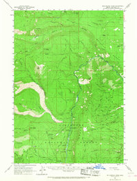
1961 Map of Whitewater River
USGS Topo · Published 1963About this map
Metolius River drainage dominates this 1961 survey, where the boundary of the Warm Springs Indian Reservation meets the Deschutes National Forest. The landscape is defined by volcanic features, including extensive Lava flows near Bald Peter and Jefferson Lake. Human activity centers on the river corridor and the high-elevation forest management outposts, such as the Camp Creek Ranger Sta and the Alder Spring Lookout.
Find a feature on this map
73 named features on this map. Tap any name to fly to it.
Don’t see what you’re looking for? This feature index may not catch every label — zoom into the map to look around manually.
Map Details
Editions of this 1961 Whitewater River Map
2 editions found
Other maps of this area

1926 · Bend
USGS Topo · 1:125,000

1927 · Mt. Jefferson
USGS Topo · 1:125,000

1928 · Madras
USGS Topo · 1:125,000

1929 · Bend
USGS Topo · 1:125,000

1929 · Three Sisters
USGS Topo · 1:125,000

1930 · Mt. Jefferson
USGS Topo · 1:125,000

1931 · Madras
USGS Topo · 1:125,000

1932 · Three Sisters
USGS Topo · 1:125,000

1955 · Bend
USGS Topo · 1:250,000

1957 · Bend
USGS Topo · 1:250,000