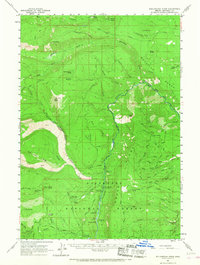
1961 Map of Whitewater River
USGS Topo · Published 1968About this map
The Warm Springs Indian Reservation Bdy and the Deschutes National Forest meet in this 1961 landscape, dominated by the drainage of the Metolius River and the Whitewater River. This era of the high cascades forest management is clearly visible through a network of fire lookouts, including Lookout Shitike Butte, Lookout Bald Peter, and Lookout Abbot Butte. The river valleys are developed for public recreation and conservation, featuring the Wizard Falls Fish Hatchery and several established campsites such as Pioneer Ford Campground and Candle Creek Campground. To the west, the volcanic character of the terrain is marked by the Jefferson Lava Lake and extensive ridges like Sugar Pine Ridge. Local infrastructure is anchored by the Camp Creek Ranger Sta, which serves as a central hub for the trails and forest roads crisscrossing the Metolius Bench.
Find a feature on this map
80 named features on this map. Tap any name to fly to it.
Don’t see what you’re looking for? This feature index may not catch every label — zoom into the map to look around manually.
Map Details
Editions of this 1961 Whitewater River Map
2 editions found

Other maps of this area

1926 · Bend
USGS Topo · 1:125,000

1927 · Mt. Jefferson
USGS Topo · 1:125,000

1928 · Madras
USGS Topo · 1:125,000

1929 · Bend
USGS Topo · 1:125,000

1929 · Three Sisters
USGS Topo · 1:125,000

1930 · Mt. Jefferson
USGS Topo · 1:125,000

1931 · Madras
USGS Topo · 1:125,000

1932 · Three Sisters
USGS Topo · 1:125,000

1955 · Bend
USGS Topo · 1:250,000

1957 · Bend
USGS Topo · 1:250,000