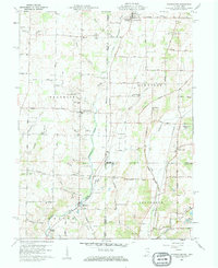
1960 Map of Whitewater
USGS Topo · Published 1961About this map
The East Fork Whitewater River carves a central path through this 1960 survey of the Indiana-Ohio borderlands, where the rural townships of Franklin, Harrison, and Jefferson converge. This agrarian landscape is defined by its small crossroads settlements and meticulous drainage networks, including White Ditch and Black Brook. The map captures a moment of established community life, anchored by numerous country houses of worship like Cedar Grove Ch and Goshen Chapel, and local education centers such as Westmont High Sch.
Find a feature on this map
68 named features on this map. Tap any name to fly to it.
Don’t see what you’re looking for? This feature index may not catch every label — zoom into the map to look around manually.
Map Details
Editions of this 1960 Whitewater Map

Other maps of this area

1915 · New Paris
USGS Topo · 1:48,000

1916 · Winchester
USGS Topo · 1:48,000

1918 · Winchester
USGS Topo · 1:62,500

1918 · New Paris
USGS Topo · 1:62,500

1943 · Winchester
USGS Topo · 1:62,500

1953 · Cincinnati
USGS Topo · 1:250,000

1953 · Muncie
USGS Topo · 1:250,000

1956 · Muncie
USGS Topo · 1:250,000

1957 · Cincinnati
USGS Topo · 1:250,000

1960 · New Madison
USGS Topo · 1:24,000