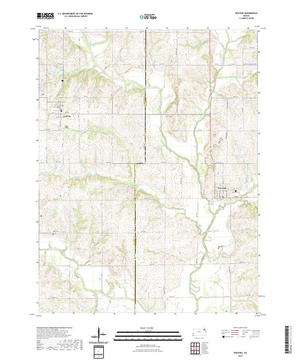
2022 Map of Whiting
USGS Topo · Published 2022About this map
Whiting and Muscotah serve as the primary hubs in this section of the Kansas plains, situated along the border of Jackson and Atchison counties. The landscape is defined by the winding course of the Delaware River and its numerous tributaries, including the Little Delaware River and Little Grasshopper Cr. The drainage patterns here create a complex network of creek valleys and ridges that dictate the placement of local roads and farmsteads.
Find a feature on this map
36 named features on this map. Tap any name to fly to it.
Don’t see what you’re looking for? This feature index may not catch every label — zoom into the map to look around manually.
Map Details
Editions of this 2022 Whiting Map
This is the sole edition of this map. No revisions or reprints were ever made.
Other maps of this area

1885 · Atchison
USGS Topo · 1:125,000

1886 · Oskaloosa
USGS Topo · 1:125,000

1888 · Oskaloosa
USGS Topo · 1:125,000

1888 · Atchison
USGS Topo · 1:125,000

1888 · Hiawatha
USGS Topo · 1:125,000

1889 · Topeka
USGS Topo · 1:125,000

1893 · Atchison
USGS Topo · 1:125,000

1894 · Oskaloosa
USGS Topo · 1:125,000

1894 · Topeka
USGS Topo · 1:125,000

1894 · Hiawatha
USGS Topo · 1:125,000