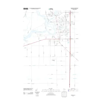
2013 Map of Whiting
USGS Topo · Published 2013About this map
The village of Whiting occupies a central position on this 2013 survey, situated where the Plover River winds its way toward the Wisconsin River. This landscape is defined by its complex hydrology, featuring numerous named water bodies such as Springville Pond, Bluebird Lake, and Lake Pacawa. The braided channels of the Wisconsin River surround Fields Island, illustrating the shifting nature of this waterway's course through central Wisconsin.
Find a feature on this map
109 named features on this map. Tap any name to fly to it.
Don’t see what you’re looking for? This feature index may not catch every label — zoom into the map to look around manually.
Map Details
Editions of this 2013 Whiting Map
This is the sole edition of this map. No revisions or reprints were ever made.
Other maps of this area

1955 · Rosholt
USGS Topo · 1:48,000

1955 · Green Bay
USGS Topo · 1:250,000

1956 · Stevens Point
USGS Topo · 1:48,000

1957 · Amherst
USGS Topo · 1:48,000

1957 · Whiting
USGS Topo · 1:48,000

1969 · Arnott
USGS Topo · 1:24,000
1969 · Almond
USGS Topo · 1:24,000
1969 · Polonia
USGS Topo · 1:24,000

1970 · Kellner
USGS Topo · 1:24,000

1970 · Stevens Point
USGS Topo · 1:24,000