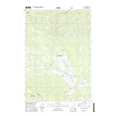
2017 Map of Whitney
USGS Topo · Published 2017About this map
Whitney occupies a central position within the Whitney Valley, a significant clearing surrounded by the dense timber of the Whitman National Forest and Malheur National Forest. The settlement's history is tied to the management of these public lands, evidenced by the network of forest roads like Gene Hale Rd and N Fork Burnt River Rd that crisscross the high-altitude terrain. Notable for genealogists, the Whitney Cem sits just east of the primary settlement area.
Find a feature on this map
60 named features on this map. Tap any name to fly to it.
Don’t see what you’re looking for? This feature index may not catch every label — zoom into the map to look around manually.
Map Details
Editions of this 2017 Whitney Map
This is the sole edition of this map. No revisions or reprints were ever made.
Other maps of this area

1901 · Sumpter
USGS Topo · 1:125,000

1955 · Canyon City
USGS Topo · 1:250,000

1959 · Canyon City
USGS Topo · 1:250,000

1961 · Whitney
USGS Topo · 1:24,000

1972 · Austin
USGS Topo · 1:24,000

1972 · Mt. Ireland
USGS Topo · 1:24,000
1972 · Bourne
USGS Topo · 1:24,000
1972 · Granite
USGS Topo · 1:24,000
1972 · Sumpter
USGS Topo · 1:24,000

1972 · Greenhorn
USGS Topo · 1:24,000